Languages
Lubusz Nordic Walking Trails – From the Sacral Triangle to Christ the King – Lubrza and the surroundings
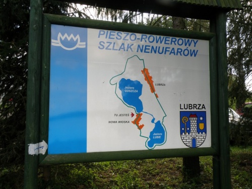
Nenufarów Trail
Route: Lubrza – Nowa Wioska – Lubrza (8 km/blue)
Trail type: natural and scenic
Difficulty level – easy
Walking time – 1.5 h
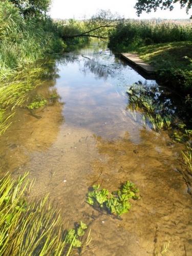
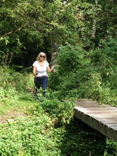
Values – the trail leads around Lubie and Goszcza Lakes. There are several places to rest on the trail with benches and shelters. Information boards on natural values of both lakes can also be found there.
Trail description:
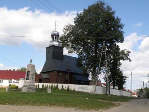
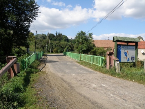
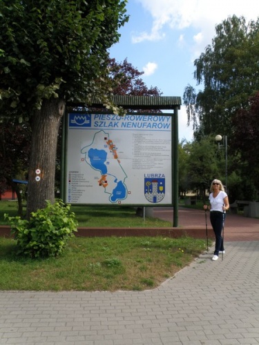
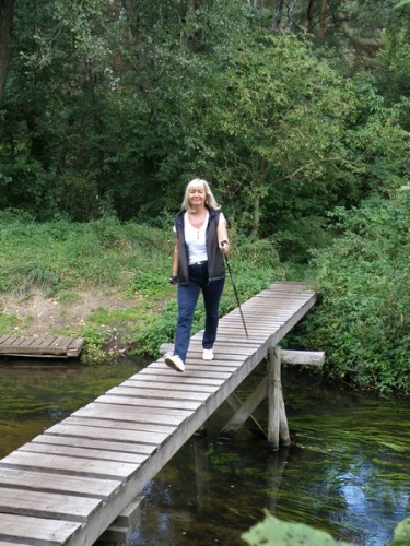
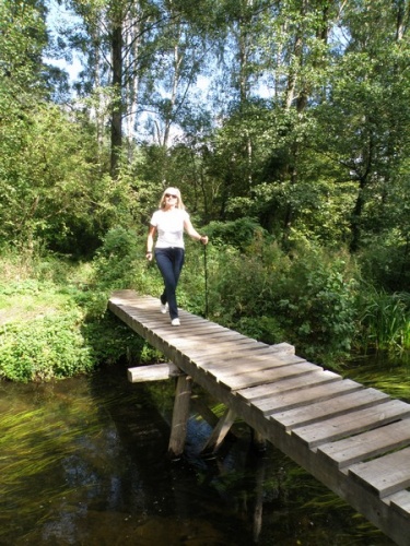
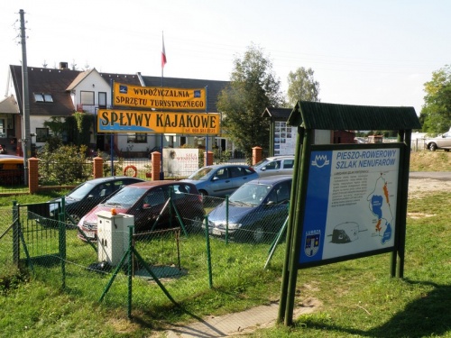
The trail starts at the square "at the tank" in the center of Lubrza. There is a parking lot on the spot. It leads south along the village and after passing the stadium turns to the shore of the Lubie Lake. Further on along the southern shore leads to the village of Nowa Wioska, where you can see the sliding bridge which is part of the fortifications of Międzyrzecz Fortified Region. Further on the trail leads along Goszcza Lake and then through the summer part of Lubrza back to the square "at the tank." At the lakes there are numerous places to rest with benches, shelters and boards informing about natural values of the lakes and Lubrza surroundings.
Boryszyn Loop – Nordic Walking
Route: Lubrza – Boryszyn – Lubrza (17 km/red)
Trail type: historical – scenic
Difficulty level – easy
Walking time – 3.5 h
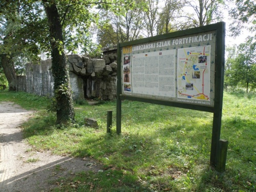
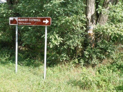
Values – the route leads through forest roads to the "Boryszyn Loop" Underground Tourist Route. Along the way it passes the MRU facilities: a fortress weir and a large battle shelter, as well as the ruins of an old watermill. At the Rakownik channel crossing, the view on Paklicko Wielkie Lake is magnificent. In the middle of the route you can visit the undergrounds of "Boryszyn Loop."
Description:
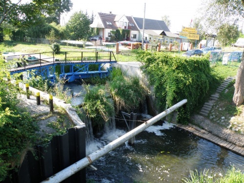
The trail starts in the center of Lubrza, at the square "by the tank” (there are parking lots for those who want to leave their car) and runs in the southern direction. Then it turns towards Jordanów, by OW Martinez it turns to north-east and along a forest road, passing under A2 highway, leads to the outlet of Rakownik channel (canoe trail) to Paklicko Wielkie Lake. It is a perfect place to rest. It is also a place for kayakers going from Lubrza to Jordanów and a fragment of a cycling marathon route for the Boryszyńska Loop Cup, held here in early July. 100 m before the crossing, on the left, there is a fortress weir (Stau 714), and 200 m further, a huge, two-storey battle shelter (Panzerwerk 706). These are elements of the Międzyrzecz Fortified Region. Bunker 706 is a large object, unfortunately blown up by the Soviet sappers. The trail will lead you around the bunker.
Further the trail leads along a road surrounded by a pine forest to the ruins of an old watermill on the Paklica River and then through the fields to the "Boryszyn Loop" Underground Tourist Route. The Boryszyn Loop Underground Tourist Route is No. 5 Armored Battery, which is part of the Central Section of Międzyrzecz Fortified Region. It consists of several huge chambers, connected by tunnels. All this is located at a depth of several to almost 30 meters. In the undergrounds you can visit specially prepared exhibitions devoted to Polish fortifications and war technology. Boryszyn Loop is also a habitat of Bats, which can be found here from late summer to early spring. By the bunkers, there are resting places with benches and roofing. The facility is open to visitors from 15 April to 15 October (www.bunkry.lubrza.pl). After visiting the bunkers, the trail leads through Boryszyn and Staropole back to Lubrza. On the way, before the village of Boryszyn, we pass another bunker (PzW 778 – possibility of self-guided tour) and a tactical channel, the task of which was to obstruct the enemy’s movements. Along the road there are remains of anti-tank barrage. In Staropol, only 300 m away from Boryszyn, you will find another bunker (Pz.W. 780 – possibility of independent sightseeing), former manor buildings and a church. After passing the sports field the trail goes further along the district road surrounded by a pine forest. Before Lubrza you again pass the A2 highway, this time on the upper side. At the very beginning of village, at the junction with the blue trail you can see another bunker (Pz.W. 694 – visiting after consultation with the owner). 200 m after the bunker you pass a bridge next to which on the right you can see a fortress weir enabling quick flooding of the lower terrain. Next to it there is a canoeing shelter, from where we can start canoeing to Jordanów and further to Międzyrzecze. After walking another 300 meters you will finish the hike on the square by the tank again.
Gallery:
Localization:
The public task is co-financed from the funds received from the Marshal's Office of the Lubuskie Voivodeship