Languages
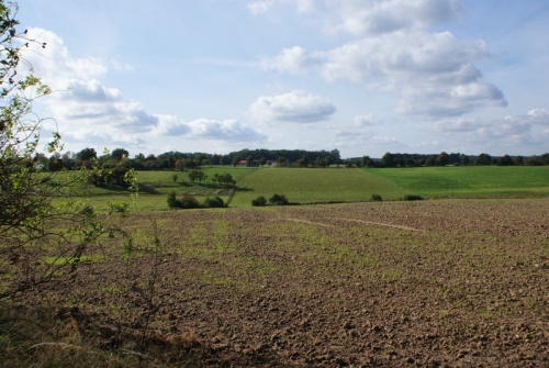
Lubusz Nordic Walking Trails – Cultural trail through the centuries – Trails around Dychów, Bronków and Brzeźnica
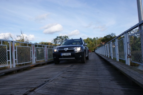
Little Dam Trail Blue Trail
Route: Pension Dychów – around the reservoir – Pension Dychów
Route type: scenic
Difficulty level: easy
Walking time: 1.5h (4.4 km)
Route around a water reservoir at the pumped storage power plant in Dychów, the oldest of its kind in Poland.
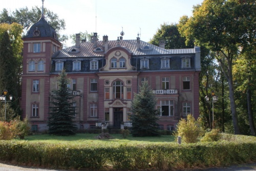
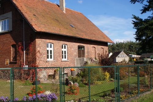
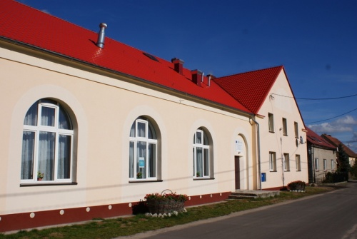
Pension Dychów
The facility is located in adapted unused today power plant buildings. It offers catering in the restaurant, accommodation in 37 rooms and the possibility of organizing meetings, trainings and conferences in several rooms of different sizes. Therefore, it can be a base for nordic walking routes in the vicinity.
About the power plant
The Dychów Power Plant is a pumped-storage power plant using the water of the Bóbr River. It is the biggest water power plant in Lubusz with an interesting history. The construction of the Dychów Hydroelectric Power Plant began in November 1933 by order of Markische Elektrizitatswerk A. G. (MEW) from Berlin. The term Markische means Marche. The term comes from March, the pre-war name for this part of Germany. After the modernization of the power plant between 2002 and 2005 the capacity was increased to 90 MW and the efficiency of pumping cycle to 71%. The ground on which the power station foundations were laid is not stable. Already during construction there were several landslides. Despite the difficulties, the first turbine set started on November 4, 1936. The second in 1937 and the third in 1939.
About the post-45 power plant
The power plant operated until February 25, 1945, when its manager shut it down upon hearing that the bridge over the Oder River at Krosno had been blown up. A few weeks later, when the area was occupied by the Red Army and the inhabitants of surrounding villages were forced to dismantle its equipment.
On August 23, 1945 the Polish administrative authorities took over the power plant. It was deprived of all facilities and basic equipment. Despite the devastation and lack of equipment, the rebuilding work began. On August 1, 1946 the Power Plant Rebuilding Office was established. In the autumn of 1948 a team of Soviet specialists arrives in Dychów to make an inventory. In July the first deliveries of equipment from the USSR "arrive.” The old pumps were brought back and some of the equipment was copied by the Russians from those they had exported. On September 30, 1951 the first turbine set was launched, and a year later another one. Today the annual production of the power plant in Dychów is estimated at 80.000 MWh. Accountancy books of the power plant in the 1940s showed slightly less.
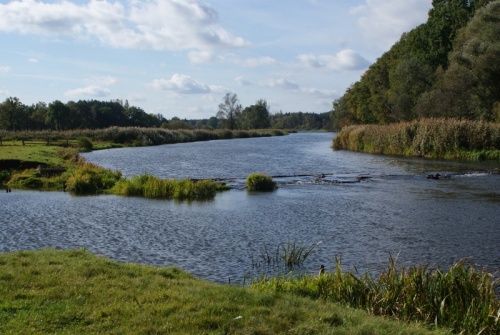
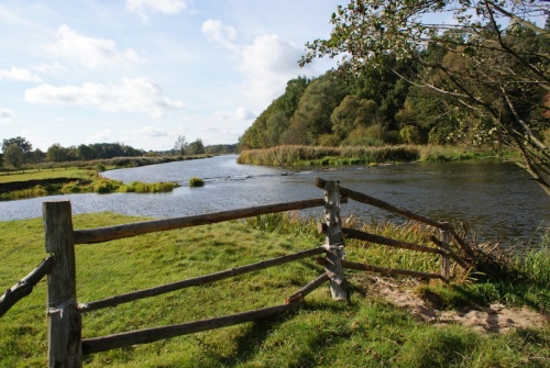
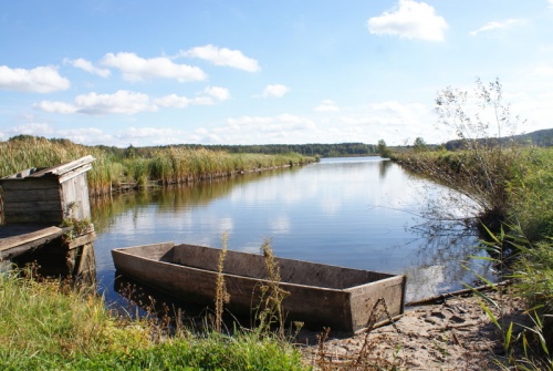
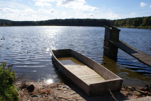
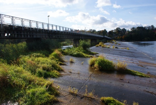
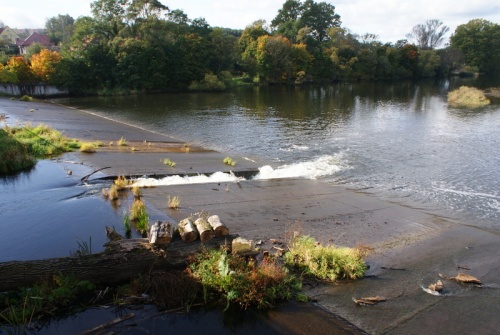
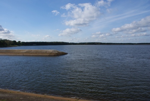
About the reservoir and the channel
The largest structure of the hydrotechnical system is not the dam, but the 20.4 km long channel that supplies water to the reservoir. The channel starts in Krzywaniec. Earthworks on the channel required moving 2.2 million m3 of soil, 130.000 m3 of concrete were used, which covered 780.000 m2. Along the route of channel bringing water to the reservoir, 8 road bridges, 1 railroad bridge and 7 siphon culverts were built. The reservoir collects 4 million cubic meters of water. Its surface area is about one hundred hectares. The depth in the deepest place –10 meters.
On April 23, 1997 there was a serious catastrophe. Nearly 60.000 m3 from one of the reservoir walls collapsed. A threat of liquidation hung over the power plant. Fortunately, the situation is under control and the power plant is running on full "water."
About the power plant complex of Dychów today
Hydroelectric power plants usually operate in pairs. Below a larger dam a smaller one is usually build. In the case of Dychowo this "smaller" dam is in Raduszcz Stary. The installed capacity of the tri-units is about 2 MW. Zespół Elektrowni Wodnych Dychów comprises 18 water power plants and weirs on the Bóbr and Nysa Łużycka rivers. Out of which 7 are located on the Bóbr above Dychów. In Krzywaniec, Gorzupia, Grajówka, Żagań, Małomice, Szprotawa. There is also a power plant on the Kwisa River, a tributary of the Bóbr River, in Kliczków.
The Great Dam and Ponds Trail Blue Trail
Route: Pension Dychów – crossing at the foot of dam – along the Bóbr River – Dychów – Pension
Route type: scenic and historical
Difficulty level: easy
Walking time: 2h (5.9 km)
Attractions: Route next to unusual engineering work. A monument and at the same time an efficient power plant with interesting contexts of the Second World War history.
Water horseshoes RED TRAIL
Route: Bronków – forests around Bronków Lake – Bronków
Route type: scenic
Difficulty level: easy
Walking time: 2,5h (8,8)
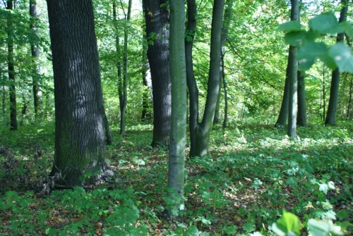
Attractions: The trail runs through pine forests located on moraine hills. Next to it there is one of them called Kępniak, 112 m above the sea level. The meridian 15o east passes through Bronków.
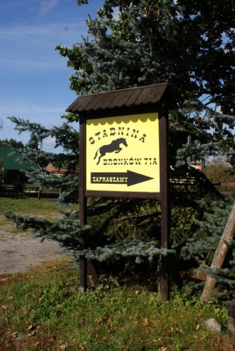
1. The route starts at the Sports Stables in Bronków and runs around the lake through pine forests. Those interested can leave the trail and climb the moraine hill Kępniak.
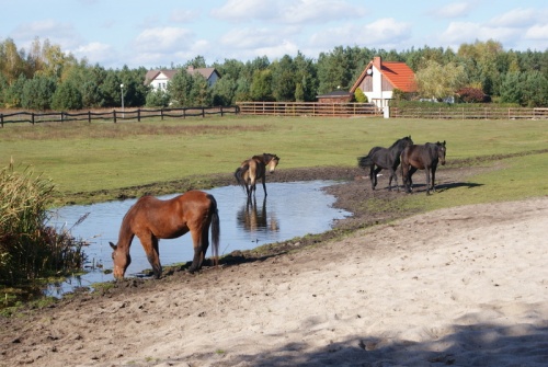
Bronków Sports Stable
Bronków Sports Stable is a picturesque sports riding center that has existed since 1997. It deals mainly with the training of sport horses but also with the teaching of riding on horses. Both young and older horses are trained in the stable. There is breeding but also rearing of foals and young horses. Very professional and titled specialists work there.
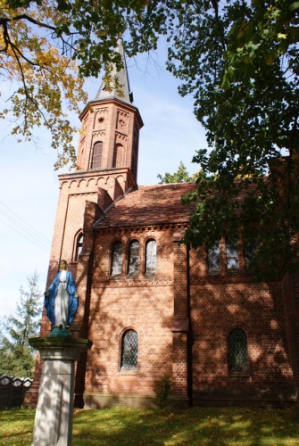
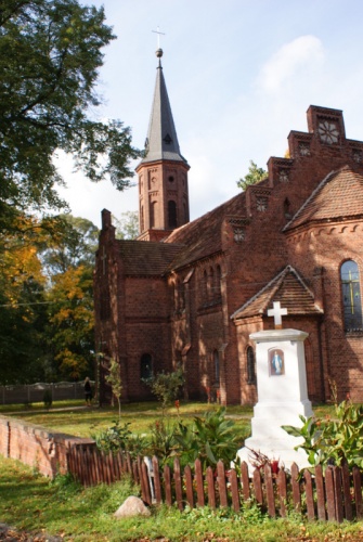
Bronków
Bronków is a village with an interesting but not very well researched history. In historical sources Bronków is mentioned for the first time on 18.03.1374 as Drusin. Later, it exists as Drausen. It appears in 1645 on the map of Lower Silesia as Bracke, a village with a church. On the map of the Duchy of Krosno from 1746 it appears under the name Branke. In a slightly later Silesian Atlas published in 1752, it appears as Btronków. On Franz Ludwig Gussefeld’s map from 1773 it is called Branck. In the next one from 1809 it is called Brankow.
Interesting facts
Near the church, under the forest, there is a cemetery, in place of the German cemetery liquidated in the postwar years. At the entrance there is an obelisk with a dozen or so names of Bronków inhabitants killed in the First World War. It is worth comparing the number of names with the number of inhabitants at that time. In the interwar years, there was a peat mining center in Bronków. In 1910, a census showed 428 inhabitants. Today (2011) Bronków has 309 inhabitants. There are several tourist farms in Bronków offering accommodation. The 15th parallel passes through Bronków, which means that the astronomical time is the same as the administrative time.
Landscape
The landscape around Bronków was shaped by the glacier. East of the village we can find moraine hills and the highest one called Kepniak is 112 m above sea level. Not so long ago, in 2003, not far from the top, there was a wooden observation tower, what remains of it today. The area near Bronków, with the surface of 3529 ha, was classified by the Lubusz Voivodeship Governor as a protected landscape area under item 26. Forests are mainly pine.
Lake
Bronków Lake is of post-glacial origin. Supplied by underground waters. It is the beginning of the Olsza River, also called Jeziornica, which flows into the Bóbr River near Kosarzyn. The total surface of this lake is 52,1 ha, the maximum depth is 6 m, the bottom is sandy and muddy, overgrown with underwater plants. In the lake you can count on catching carps and amurs weighing a dozen or so kilograms. There are also zanders, breams and tenches. Once a 3 kg eel was caught on this lake. By the lake, there is the Recreation Complex in Kołatka with 150 places, with all-season and heated cottages, ideal for rest at any time of the year.
Lower Bóbr Valley Trail DARK GREEN
Route: Brzeźnica – along the Bóbr River – Stary Zagór – Nowy Zagór
Route type: scenic and historical
Difficulty level: easy
Walking time: 3h (9.7 km)
Attractions: Extremely picturesque gorge of the Bóbr River flowing in deep meanders. The whole is part of a protected landscape area. In Nowy Zagora, a penitential cross.
1. Brzeźnica
Brzeźnica (German: Briesnitz) is a relatively young village established at the turn of the 17th and 18th centuries as a manor settlement. At the beginning of the 19th century 167 inhabitants lived in Brzeźnica. Two water mills, a brickyard and a smithy operated there. From 1863, Brzeźnica belonged to Karl Riedel and it was probably him who, 1907-1908, in the place of the older mansion, built the magnificent residence which exists until today. The Brzeźnica estate covered 645.10 ha, including 187 ha of arable land, 19.7 ha of waters, 21 ha of meadows and 417 ha of forests.
Palace description
The palace is located in the center of rectangular manor layout, inside of which there is a courtyard surrounded by buildings. This eclectic three-storey palace is set on a high basement, set on a rectangular plan, covered with a mansard roof. The mass of building is crowned with a four-storey tower with domed cupola. The palace facades are decorated with risalits and one-storey outbuildings. They are decorated with cornices, rusticated pilasters and decorative window frames. The eastern facade bears the date 1908, which commemorates the time when the palace was built.
From the south, there is a landscape park, established in the 19th century, which stretches to the south of the residence and descends in the direction. It contains 53 species of trees, including interesting specimens of ginkgo and a natural monument – Querkus robur with a circumference of 550 cm and a height of 22 m, estimated to be 300 years old.
Palace history
The palace went through a typical for palaces in this part of Poland history. First, after the Second World War it housed the garrison headquarters of the Soviet Army. In 50s of the 20th century the palace was taken over by state and served for social care and until 2007 it was the seat of Social Welfare Home.
Lower Bóbr Valley
The area "Lower Bóbr Valley" belonging to the Natura 2000 area covers the valley of Bóbr River on the section from Żagań to Dychów. It is divided into northern and southern parts. The southern part from Żagań to Nowogród. The northern part, from Nowogród to Dychów. A deeply cut riverbed, with meanders, oxbow lakes and floodplain meadows on both banks. Along the banks there are riverside willow thickets and the remains of willow riparian forests and scattered water bodies. The area is of great ecological importance for the preservation of landscape and species typical for a lowland river valley flowing between moraine hills. There are also important sites of green snaketail, European stag beetle and Eurasian beaver. There is also one otter site. The area is also important for the protection of Sabanejewia aurata, a small fish of 10 cm in length that lives in swift and clear rivers with stony bottoms.
Stary Zagór
Stary Zagór (German: Wendisch Sagar and in 1937-1945 – Bobertal). The history of the village is poorly researched. The name Wendisch in German indicates that the Sorbs lived there. It was precisely to hide this fact that the name of village was changed to Bobertal. Archaeological research in the vicinity of Nowy Zagór proves the settlement from the Bronze Age, i.e. around 1500 BC.
New Zagór
Nowy Zagór (German: Deutsch Sagar and in 1937-1945 – Boberhoh). The village was recorded in chronicles as early as 1531, when the Elector of Brandenburg, Johann, gave the combined estates in Nowy Zagór and Dąbki as a fief to Hans von Knobelsdorf. But the real development of both villages began in the early 19th century, when in 1815 the estate was bought by August von Rheinbaben. Together with his wife and four children he settled down in the estate and lived in Dąbki in a magnificent straw thatched house. Already in 1820 he built a more magnificent palace, but it was still one-storey. Since 1827, when he became the Landrat of the Krosno County, he actively worked for the benefit of the county. It is thanks to his efforts that the national road Gubin-Krosno-Sulechów and the road from Krosno to Nowogród were built. August’s work was taken over by his son William in 1859. He became a Landrat and continued his father’s projects. During his period of activity, a railroad line from Gubin to Zbąszyń was built. He also improved the estate. He improved the brickyard, built a distillery, developed fruit farming and planted mainly cherries. He started a lignite coal mine, but the undertaking proved to be a failure. Thanks to his efforts and money the present church was built in place of the destroyed one. He died in 1891 and was buried in the local cemetery. His son in 1900 built a new residence in Dąbki adding to the old one a new impressive two-story building with a tower. Palace in Nowy Zagór was at that time a large one-storey building with numerous rooms in the attic, covered with mansard roof. The next Rheinbaben, Eugen, was better a military man than a farmer and ran the estate badly. It was his son Wilhelm, a lawyer by profession, who introduced the 20th century technology to the estate. Brickyard, distillery and potato flakes factory were among his achievements. He left the estate with his wife and children at the beginning of February 1945. From family seats in Nowy Zagór and Dąbki there is practically nothing left today. Just like with the rest of the property.
Church in Nowy Zagór
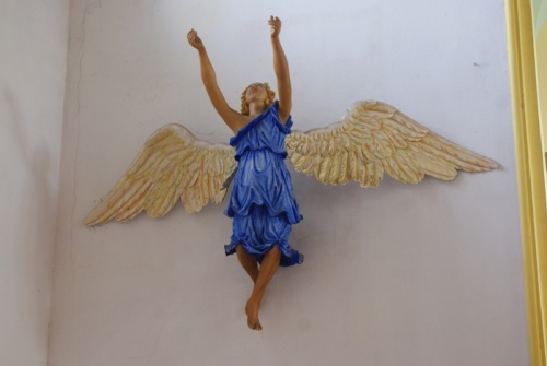
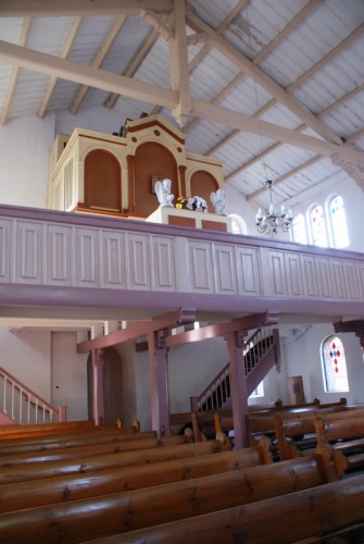
The first historical mention of the church in Nowy Zagór dates back to 1531. The next mention of the tower construction comes from 1693, but soon the church was destroyed and the reconstruction began in 1706. Single-nave church with a tower has a wooden structure filled with bricks. Seven Years War passed by Nowy Zagór and the Russians after the victorious battles over Frederick II, looted the area around Krosno and also the church in Nowy Zagór. After the Seven Years War there is a series of repairs and modifications resulting partly also from changes in liturgy. However, the church did not meet the ambitions of the Rheinbaben family and finally the modern building was constructed in 1882-1886. The solid brick church was built on the foundations of previous one. The founder’s family (Rheinboben) had a separate entrance on the left side of altar. In the altar was placed a painting of Christ from the previous church. In front of the altar was a baptismal font and above it hung a winged angel, today located on the wall to the altar’s left. In the back there was a choir with an organ on it.
Penitential cross
In front of the church in Zagórze Nowe stands the penitential cross, or as some say the Cross of Reconciliation. Its age German sources estimate at about 700 years. Supposedly it was a punishment for killing by the master of his sheepherder. Another legend connected it with the 17th century and the penitential cross in Ochla near Zielona Góra. It says that the cross was put up by the widow of a sheepherder from Ochla, who, escaping from her husband’s persecutor, founded the cross in Stare Zagórze. However, as a result of a lawsuit, the killer was forced to make financial reparation and placed the cross in Ochla by the local church.
Kosarzyńskie Landscapes Blue Trail 5.3 km
Route: Route around Borek Lake
Route type: scenic
Difficulty level: easy
Walking time: 1.5h (5.3 km)
Attractions: The route leads along forest paths around the lake.
The trail runs around Borek Lake on its shores, among coniferous and deciduous forests
Kosarzyn
Kosarzyn (German: Kuschern, Latin: Kóšarnja) was first mentioned in documents from 1316 as Cuscherin, and then in 1432 as Koscherin. The village was part of the estate of the Cistercian monastery in Neuzelle. Since 1933 the village has been protected by a weir, and after the war by a pumping station. Just before the war Koscherin together with the farmhouse and mills covered the area of 647 hectares with 352 inhabitants.
Interesting facts
Oil was discovered in the vicinity of Kosarzyn and since 1991 around 66.000 liters have been extracted daily. The oil was transported by tankers to the railway station in Wałowice. This deposit has been exploited until today.
To commemorate the cooperation between the nations in a common Europe, as well as the flood of 1997, which hit Ratzdorf, a wooden cross was erected at the mouth of the Neisse River to the Odra River on September 13, 2003. In spring, orchids bloom near the cross, towards the oak forest.
Borek Lake
The trough-like Borek Lake is a postglacial lake, which has tributaries Struga and Steklnik in the south. From the north, through the Łomianka channel, it connects with the Odra river. The lake is 1570 m long and 640 m wide. The surface of the water surface is 63 hectares. The maximum depth of the lake reaches 8 m. Successively restocked with fish, the lake is an attraction for fishermen. At the lake there are many recreational centers, including the "Nad Borek" Center.
Krzesiński Landscape Park
The Krzesiński Landscape Park was created in 1998 by virtue of the Zielona Góra Province Governor’s order. It is located in the communes of Cybinka, Gubin and Maszewo, and covers an area of 8546 ha. It includes not only polders and floodplains, but also high terraces adjacent to both river valleys, covered with pine forests, rising above the river level to over 30 m in some places. However, the most valuable area of the Krzesiński Landscape Park is the periodically flooded flood protection polder Krzesin-Bytomiec. The humid meadows near Bytomiec are home to several species of orchids. Due to regular flooding during high water levels, the Krzesin polder is rich in semi-natural habitats, such as: floodplain meadows, wet meadows, sedge meadows and rushes.
The Park’s water reservoirs and their surroundings are home to 13 species of amphibians, including northern crested newt and European fire-bellied toad. Six of the eight domestic reptile species live here, including the European pond turtle and the smooth snake. 218 species of birds and 41 species of mammals have been recorded in the park. Therefore, you can meet not only birds: woodpeckers, kites and harriers, but also beavers and otters, not to mention deer and roe deer. There are 9 species of bats nesting here.
Gallery:
Localization:
The public task is co-financed from the funds received from the Marshal's Office of the Lubuskie Voivodeship