Languages
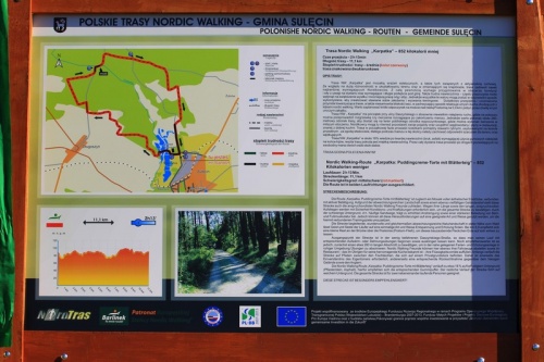
Lubusz Nordic Walking Trails – Sulęcińska Szwajcaria – near Sulęcin
„Karpatka” – 733 kilocalories less
Walking time – 2 h 13 min
Trail length – 11.1 km
Difficulty level – medium (red colour)
two-way marked route
TRAIL DESCRIPTION:
The NW route "Karpatka" is a mosaic of aesthetic impressions, as well as those associated with physical activity. Due to the large variety of terrain and changing landscape, the route will satisfy even the most demanding. It certainly requires preparation in terms of fitness and strength due to the distance as well as demanding and long uphill climbs. Also the difficult surface – often sandy – can increase the effort and make your legs and feet work harder. However, all these qualities can be used in an appropriate way to achieve your training goals and challenges.
In addition, the beautiful and varied nature accompanying the route as well as the amazing proximity of the forest will relax the mind and spirit of nordic walkers in a delightful way. It is worth planning a short rest on the bridge over the Postomia River at 5.9 km and stay for a while in this charming place.
The "Karpatka" trail starts at Daszyńskiego Street with relatively low traffic intensity, where you can warm up or do stretching exercises after finishing the walk. It is worth to overcome about 280 meters of the trail to get to the area of the nearby recreation center, where it is possible to do exercises in a nicer environment, leave your vehicles and replenish carbohydrates and fluids in the restaurant, well-known for its good cuisine. The trail at the beginning leads along paths between fishing ponds, located on private property with the owner’s permission, so you should be respectful of the area and anglers when walking in this area.
About 18% of the Karpatka trail runs on hard surfaces (cobblestones, asphalt) requiring the use of rubber pads for the ends of your sticks, while the rest of trail is covered with soft surfaces. For the entire distance the route leads along roads allowing two people to walk side by side.
Routing:
The "Karpatka" trail starts in Daszyńskiego Street, near the intersection with Lipowa Street, in a place where a short asphalt branch leads to the "Kormoran" Center. This is where the "Karpatka" NW trail starts, leading to the "Kormoran" Centre. Here the trail runs along the parking lot, passing accommodation and a restaurant on the right, then it turns left and enters between fish ponds. After passing the first fishponds, the trail goes over a bridge and turns left, then right, passing more fishponds, and behind them it turns left again and then right, leading along a path straight ahead to a forest road, where it turns right. The route then follows the sandy road along the forest line on the left and leads to a crossroads where it turns left. The route leads straight on towards Długoszyn and, reaching the field line, turns right. It continues along the edge of forest, crosses the crossroads straight ahead, then turns left and leads straight on to the next turning right. Then, with slight undulations, it reaches a crossroads, where it turns left and along a forest road leads to the pavement leading from Długoszyn to Żubrów. Further on, for about 320 meters, the route runs along the pavement and then turns left into the forest. After about 200 meters the route turns right and follows the forest road straight ahead passing successive intersections until it reaches a forest crossroads where it turns right.
After a turn, the trail leads straight ahead again, crossing a path and entering a forest road, with which it is connected from the right and along with this road, after a slight turning to the left, it reaches a paved section of the road, leading to a bridge over the Postomia River. Then it crosses the bridge and along the sandy road it reaches a descent to the right, into which it turns and just after which it turns right again. The trail, with a forest road, leads slightly uphill and straight ahead until it reaches a larger forest road junction, which it crosses straight ahead and continues slightly uphill for about 840 meters until it takes a right turn. After the turn, the NW "Karpatka" trail heads straight on through the forest, passing intersections and leading to a road where it takes a sharp left turn. Next uphill, after about 250 meters the trail turns right and after a while leads out of the forest onto a road leading through fields and meadows. The trail goes straight ahead and once again enters the forest and continues straight until it reaches a characteristic place with an open space, where it turns right after a slight bend and continues through the forest to a wider road paved with cobblestones, on which it turns left and along which leads to an asphalt section with expansion areas covered with compacted sand. Along the asphalt the trail reaches the start/finish point where it closes the loop.
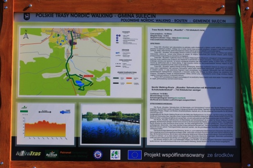
"Wuzetka" – 733 kilocalories less
Walking time – 1h 50 min
Trail length – 9.3 km
Difficulty level – easy (green colour)
two-way marked route
TRAIL DESCRIPTION:
The "Wuzetka" trail meets the needs of people walking with nordic walking sticks, who feel more secure on stable ground. Therefore, most of the trail leads along paths and roads with hard surfaces (paving stones, asphalt, compacted ground), where it is necessary to take rubber pads for the tips of nordic sticks.
The "Wuzetka" starts almost in the centre of Sulęcin and leads along Witosa Street to Ostrowskie Lake, surrounds it, and returns along Witosa Street to the town. At the start/finish there is not much space where you can warm up or do some stretching exercises.
The "Wuzetka" is mainly intended for those who use a less advanced technique of nordic walking and who feel insecure in solitude in a forest environment. The trail is easy and, with the exception of a short section by the lake with roots and which first descends and then ascends slightly, it can be defined as relatively flat. For this reason it is ideal for training in basic nordic walking techniques.
The "Wuzetka" NW trail also fulfils a recreational function, providing an opportunity to reach a charming beach with bathing site at Ostrowskie Lake, where it is worth taking a rest, sunbathing or cooling down in the lake waters. Certainly, the part of the route leading to Ostrowskie Lake is worth overcoming the earlier inconveniences related to walking along Witosa Street, which is the place of everyday traffic. Special attention should be paid to safety when crossing the road between the cycling and walking route and the forest area.
The route is 96% on roads allowing two people to walk side by side. The remaining part is a narrow, single-person section of forest path.
Routing:
The "Wuzetka" NW route starts in the town, behind the bus station, next to the shop on Witosa Street. The route runs along the sidewalk of Witosa Street in a southerly direction and follows the sidewalk as well as the cycling and walking path for 3.1 km to a place with a signpost, where it turns left, crossing an asphalt road and entering a forest area. Then, after about 115 meters, the trail turns right and along the forest road straight ahead leads to Ostrowskie Lake. At the lake, the route descends slightly on a single track following a curve to the left until it reaches a junction, where it turns right uphill, leaving the water mirror behind. The route continues in a slight curve to the right and then straight on to reach a cobbled road, where it turns left and follows the right sandy side of the road along the cobbles. After about 240 meters the route turns left and along a sandy forest road leads to the beach at Ostrowskie Lake. At the beach, the trail turns right and runs until it takes a distinctive left turn, after which it crosses a small stream and continues straight ahead, passing Camping Marina on the left and reaching an internal asphalt road. At the asphalt, the route turns right and then immediately left and leads to the main road No 138 (an extension of Witosa Street). The route crosses the road (please watch out for vehicles!) and returns to the paved bicycle and pedestrian path, where it turns right and continues straight ahead to reach the starting/finishing point in Sulęcin.
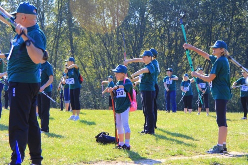
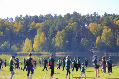
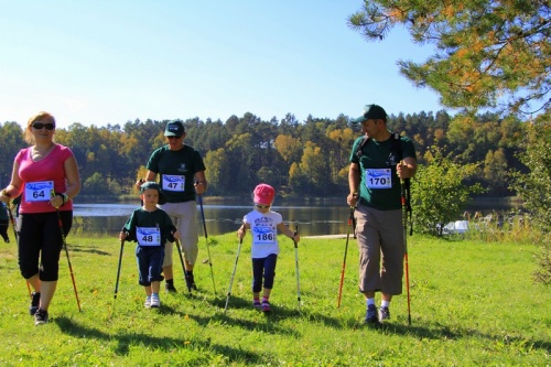
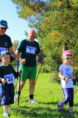
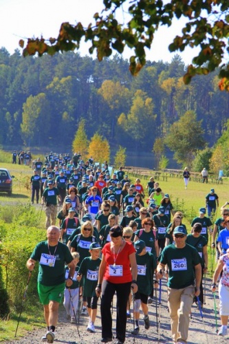
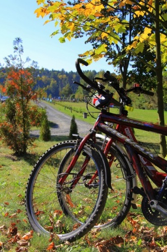
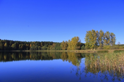
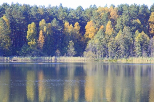
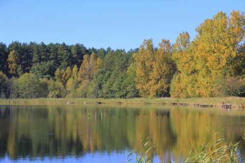
Gallery:

Localization:
The public task is co-financed from the funds received from the Marshal's Office of the Lubuskie Voivodeship